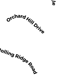
14 ROLLING RIDGE RD
Owner Information
CME OMALLEY TRUST & OMALLEY CAROL TRUSTEE
14 ROLLING RIDGE RD
None, None None


Property Details
14 ROLLING RIDGE RD is classified as a Single Family Residential (Cape cod).
The primary structure on this property was built in 1993. There are 2,448ft2 of built area within this property. There is 1,428ft2 of residential/living space within this property. This property is listed as having 7 rooms.
14 ROLLING RIDGE RD is valued at $233,800. The land is valued at $64,800 and the structures are valued at $169,000.
The most recent deed for 14 ROLLING RIDGE RD is recorded at the local registrar in Book 62863, Page 71. 14 ROLLING RIDGE RD was last sold on Thursday, July 23, 2020 for $100.
Assessment data from fiscal year 2021.
Flood Data
According to the FEMA National Flood Hazard Layer, this property does not appear to be in a flood zone. It may also be in an area not yet reviewed. Nonetheless, confirm this information prior to taking any action.
To view the flood hazards around this property, create a FEMA "Firmette" Map of the area around 14 ROLLING RIDGE RD.
Broadband Internet Providers
| Provider | Type | Bandwidth (mbps) | |
|---|---|---|---|
| HughesNet | Satellite | 25 | 3 |
| Viasat Inc | Satellite | 100 | 3 |
| Verizon New England Inc. | DSL | 10 | 1 |
| VSAT Systems, LLC. | Satellite | 2 | 1 |
| Charter Communications Inc | Cable | 940 | 35 |
| GCI Communication Corp. | Satellite | 0 | 0 |
Broadband service provider data from December 2020.
Adjacent Properties
- 18 ORCHARD HILL DR
Single Family Residential owned by CHUPLIS JOSEPH J - 12 ROLLING RIDGE RD
Single Family Residential owned by AMESIMEKU JANET - 8 ORCHARD HILL DR
Single Family Residential owned by WHITE DANIELLE - 10 ORCHARD HILL DR
Single Family Residential owned by DELORIEA WILLIAM R - 20 ORCHARD HILL DR
Single Family Residential owned by BOWMAN CHRISTOPHER B